Snowstorm Project
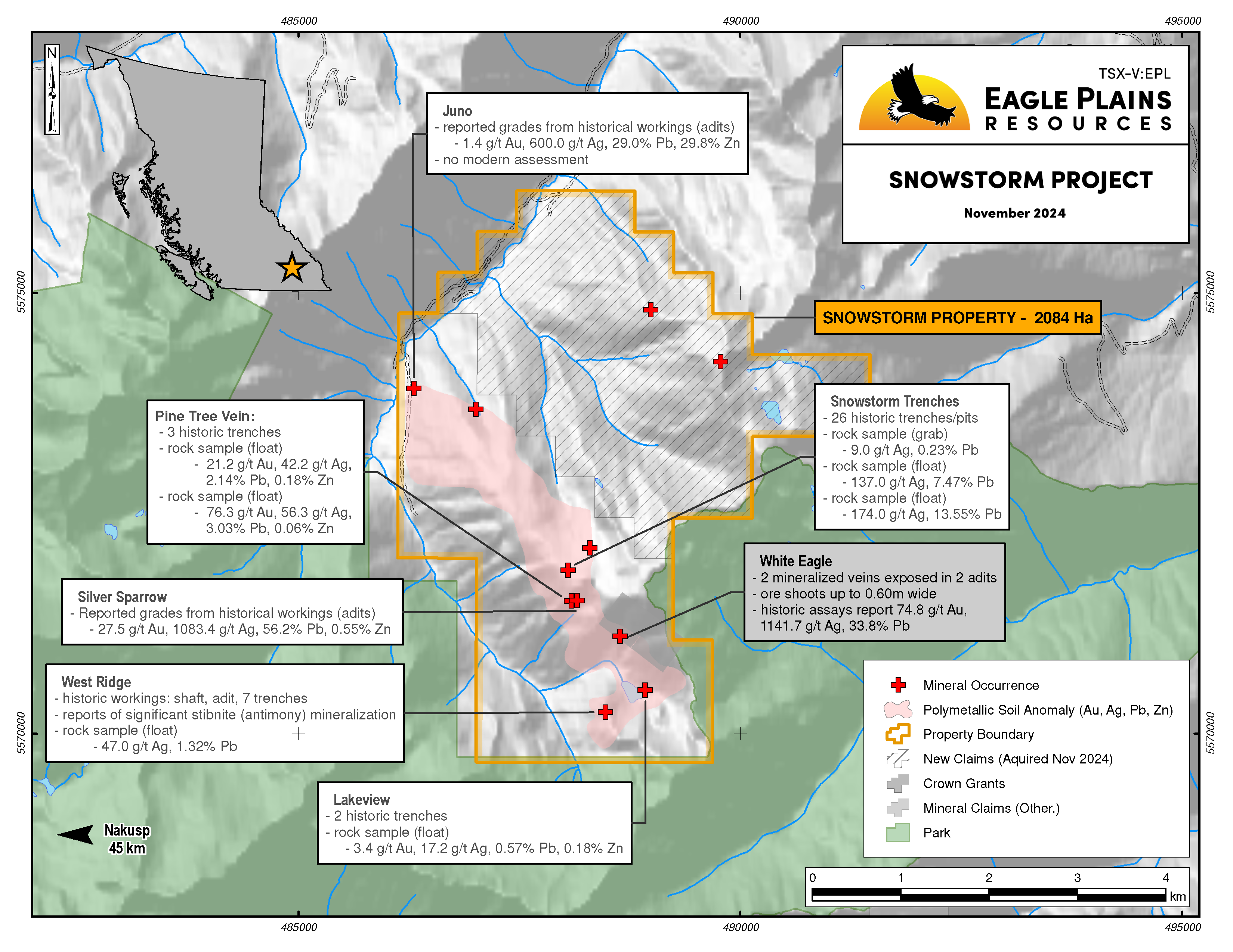
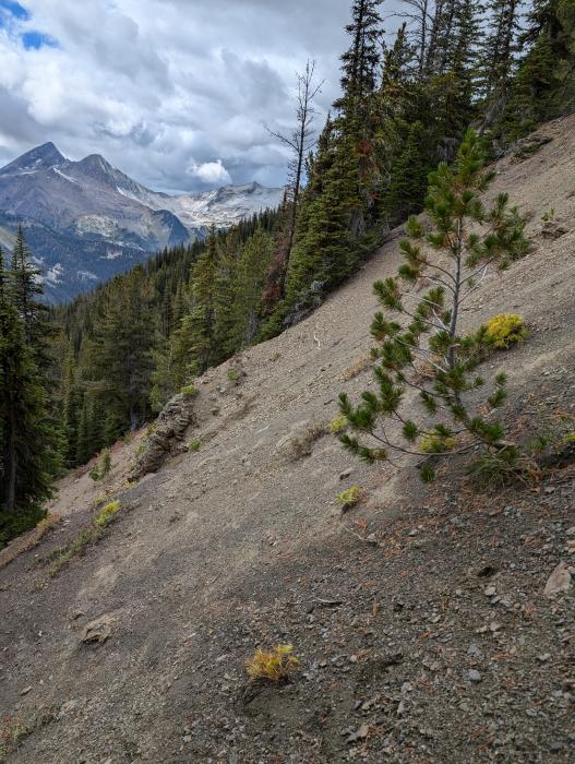
The 2084 ha Snowstorm Property, located 45 km east of Nakusp, BC, hosts high-grade Au-Ag-Pb-Zn. Mineralization typically forms as sulphide ore shoots hosted in structurally controlled quartz-carbonate veins that can be up to 2.0 m wide and as disseminations and cleavage infill proximal to mineralized veins. The property contains significant historical workings dating back to the late 1920’s but has only seen limited surficial exploration work after 1933 with no diamond drilling to date. The property is currently only accessibly via helicopter but a decommissioned logging road could provide access up the Cascade Creek drainage for future work programs.
-
- British Columbia
-
- Available for option: Yes
-
- Gold,
- Silver,
- Zinc,
- Lead,
- Copper
Project Highlights
- Located in the historic Slocan Mining Camp
- Numerous polymetallic (Au-Ag-Pb-Zn±Sb±Cu) high-grade showings focussed along major structures over 5 km
- All known mineral occurrences are open at depth and along strike
- Under explored with no diamond drilling
- Soil geochemistry anomalies highlight historical workings and identifies new, untested target zones
Details
The 2084 ha Snowstorm Property, located 45 km east of Nakusp, BC, hosts high-grade Au-Ag-Pb-Zn. Mineralization typically forms as sulphide ore shoots hosted in structurally controlled quartz-carbonate veins that can be up to 2.0 m wide and as disseminations and cleavage infill proximal to mineralized veins.
The property contains significant historical workings dating back to the late 1920’s but has only seen limited surficial exploration work after 1933 with no diamond drilling to date. The property is currently only accessibly via helicopter but a decommissioned logging road could provide access up the Cascade Creek drainage for future work programs.
Project Highlights
- Located in the historic Slocan Mining Camp
- Numerous polymetallic (Au-Ag-Pb-Zn±Sb±Cu) high-grade showings focussed along major structures over 5 km
- All known mineral occurrences are open at depth and along strike
- Under explored with no diamond drilling
- Soil geochemistry anomalies highlight historical workings and identifies new, untested target zones.
Geology
The Snowstorm property overlies geology of the Early Palaeozoic to Jurassic Lardeau Group. The assemblage forms part of the Kootenay Arc which stretches from the US border north to the Revelstoke area. Kootenay Arc sediments were deposited into subbasins formed during arc development. Regional mapping indicates that the geology underlying the property formed during gradual infill of the subbasins, dominantly by siliciclastic and variably calcareous sediments, interpreted to be a fining upward sequence as a result from basin development and sea level transgression. To the Northeast of the property is thick sequences of mafic to intermediate volcanics of the Index Formation. Within the Cascade Creek drainage, the Index Formation contains minor amounts of fine-grained siliciclastic sediments (shale and phyllite). The property, positioned on the eastern slope of Cascade Creek overlies the Triassic Broadview Formation which regionally conformable overlies the Index Formation. Rocks of the Lardeau Group were intruded by monzonites and syenites of the Lower Triassic Kuskanax Batholith. The main batholith has multiple parasitic intrusions that are mapped on the western slopes of Cascade Creek, approximately 2 km west of the current tenure boundaries.
Within the project area the Broadview Formation overlies the Index Formation with a faulted contact. The Broadview sediments can be subdivided into 5 units: andesitic volcanics; lithic sandstone-siltstone; siltstone-slate-phyllite; variably carbonaceous slate-phyllite-siltstone; and dolomitic siltstone-impure carbonates. The base of the Broadview stratigraphic sequence is marked by volcanic derived sediments and flows that are consistent with geology that makes up the Index Formation (contact is unconformable and faulted). Overlying the basal volcanic unit is the sequence of siliciclastic and carbonate sequence. The stratigraphic sequence is interpreted to represent turbidite deposits within large scale fining upward sequences resulting from sea level transgression. Mapping indicates periods of low sedimentation interpreted to be the result of decreased terrestrial erosion or rapid widening of the basin.
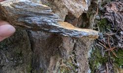
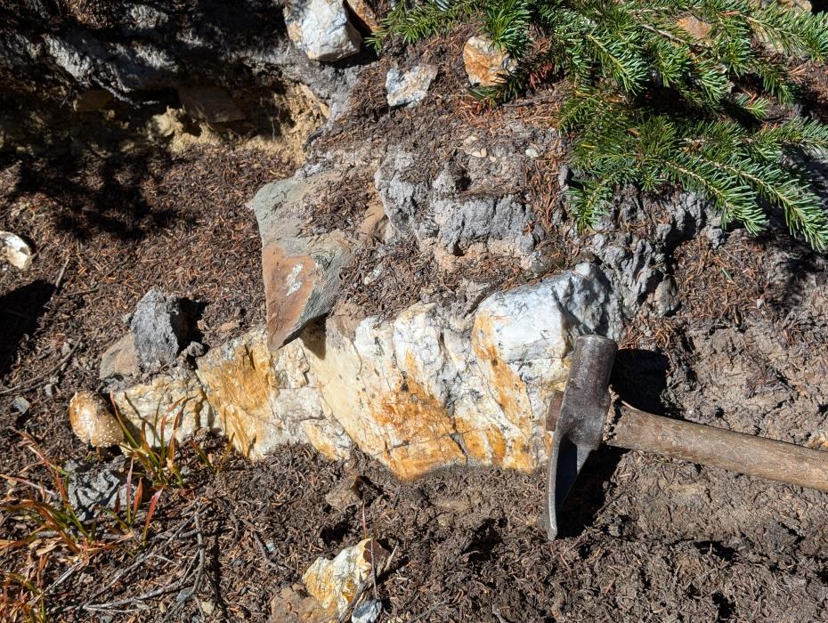
The Broadview Formation has been altered by up to 4 phases of deformation. Two major transverse faults are exposed in Cascade Creek and correlate spatially to mineralization: the Mobbs Fault and the Mount Emmens Fault. Broad mineralized veins were developed parallel with dominant cleavage and are interpreted to be coeval with the second phase of deformation. Veins are dominantly milky white quartz with lesser calcite. Veins are reported up to 2 m wide and host sulphide ore shoots containing auriferous (gold-bearing) pyrite (Fe), argentiferous (silver-bearing) galena (Pb), sphalerite (Zn) and stibnite (Sb).
History
The Snowstorm project is located within the historic Slocan mining camp in the West Kootenay, BC. The area is one of the oldest mining camps in the province, dating back to the 1820’s with the initial discovery of the Bluebell deposit near the town of Riondel (62 km SE of Snowstorm) and hosts 270+ documented mineral occurrences. Significant regional exploration within the camp started in the 1860’s, expanding the prospecting range significantly to the east and west discovering multiple other base and precious metal deposits (dominantly vein-hosted Ag-Pb-Zn).
The earliest documented work on the Snowstorm property dates back to 1925. The upper Cascade Creek valley was explored extensively between 1925-1931 which included development of surface and underground workings at the White Eagle, Snowstorm, Silver Sparrow ad Westridge by Keene Mountain Gold and Silver Mines Ltd. Concurrent exploration and development was occurring at the Juno showing by the Juno Syndicate. Ore from these workings was reportedly high-grade in nature (Au-Ag-Pb-Zn) and was shipped to the smelter in Trail, BC.
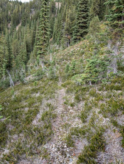
Modern exploration on the property has been limited. In 1987 Ambergate Exploration Inc. acquired the Cascade Creek claims through staking and explored the area through 1988. In 1987-1988 the exploration by Ambergate focused on re-establishing the extensive pack trail network first developed by prospectors and minors in the 1920s and 30’s, to locate and sample all known historical mineral showings, and to generate new targets through prospecting, mapping and soil sampling. Ambergate successfully rehabilitated 6.8km of pack trail and extended new trail an additional 300m greatly increasing mobility through the claim along steep west facing slopes. An extensive soil sampling campaign was completed over inferred positions of property scale thrust faults, focussing on the areas between the Juno and White Eagle workings. Prospectors discovered the Pine Tree vein (extension of the Silver Sparrow) and the Lakeview Zone. Both newly discovered zones host high grade Au-Ag-Pb mineralization. In 1994 the property was optioned by Ambergate to Lumby Resources Corp who continued exploration on the property in 1994, expanding the soil grids west of the White Eagle showing and further south to cover the Lakeview and Westridge areas. A compilation of results shows strong soil anomalies associated with known historical workings and successfully delineated other anomaly areas with no known workings that warrant modern follow-up.
In 2015 John Bakus completed a structural analysis on the property. The program identified 3 cross-structural zones with associated breccias, shearing and cross fractures that are interpreted to be the main conduit for vein and mineralizing fluids.
In 2023 Eagle Plains Resources acquired the property through staking. A single day prospecting campaign was completed in 2024 that was successful in locating and sampling historical workings. Confirmation rock samples confirmed the high-grade nature of the mineralization and a confirmation soil line confirmed an anomaly identified by Ambergate in 1987. After confirming the high-grade nature of the mineralization the property size was significantly increased at the end of 2024.
Mineralization
A total of 9 MinFile mineral occurrences are registered on the property. The occurrences describe high grade Au-Ag-Pb-Zn±Sb mineralization hosted in sulphide ore shoots within quartz-carbonate veins up to 2m wide. Veins are associated with well defined thrust faults and are subparallel to the dominant cleavage. The Snowstorm project has potential for both high-grade vein and bulk-tonnage mineralization. The following summaries are considered the main occurrences within the tenure.
Snowstorm (MinFile 082KSW086)
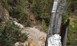
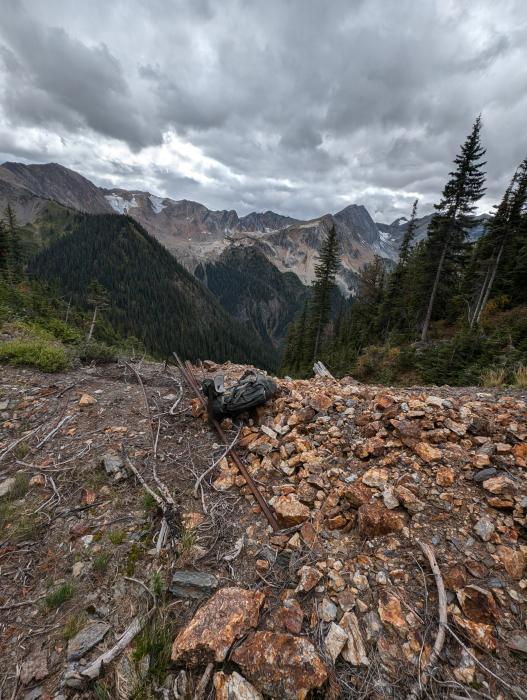
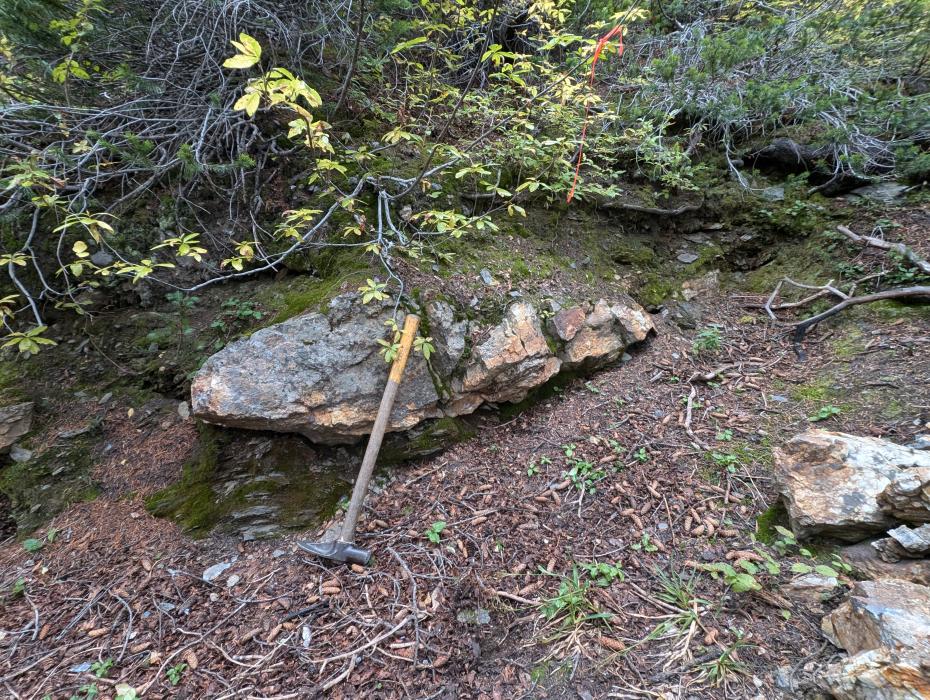
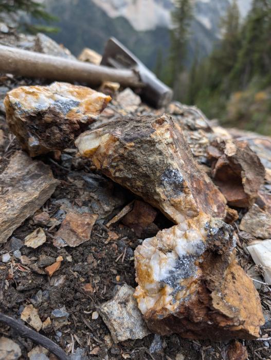
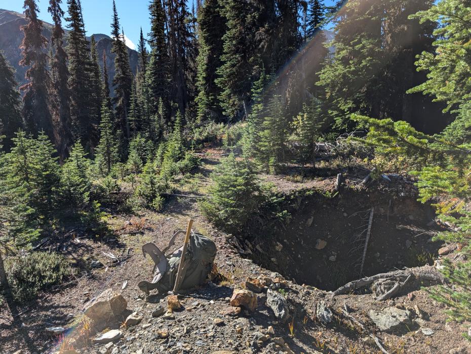
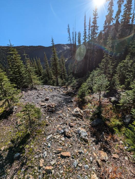
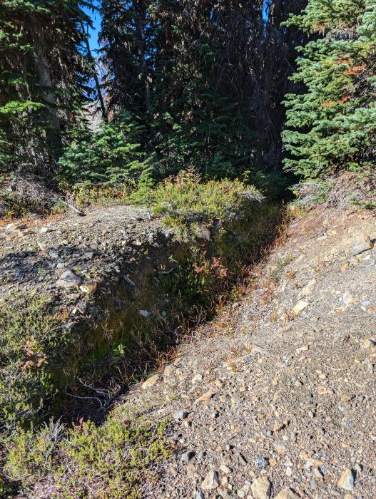
The Snowstorm occurrence is marked by a series of 26 hand dug trenches dating back to 1930-1931. The trenches were positioned to explore for mineralized quartz float and were successful in exposing a 1.5m wide quartz vein in two locations, approximately ~300m NW of the Silver Sparrow adit. Historic results from the Snowstorm trenches report 572 g/t Ag, 2.81 g.t Au, 22.4% Pb and 0.06% Cu. The area was assessed by Eagle Plains in 2024 which confirmed the high-grade nature of the zone. Field crews noted thin, mineralized quartz veins (260°/88°) that are discordant to the main Snowstorm vein orientation (145°/66°). The cross cutting vein orientations are previously unreported and warrant future investigation and structural interpretation to determine economic significance. Sample KBSWR004 (grab) was collected from a 1.5m wide quartz vein exposed in a 15m long trench returned 9.87 g/t Ag, 0.23% Pb. Sample KBSWR005 (float) was collected from a mineralized waste dump at the base of the trench and returned 0.78 g/t Au, 136.00 g/t Ag, and 7.47% Pb and sample KBSWR015 (float) returned 2.64 g/t Au, 174.00 g/t Ag, 13.55% Pb and 0.16% Zn.
Silver Sparrow (Snowstorm Shaft)
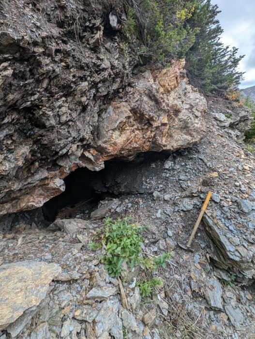
Historical reports indicate a 6.1m inclined shaft into the Silver Sparrow Vein was developed between 1930-1931. The quartz vein (102°/30°) is 1.0m wide at surface with historical results reported as 56.20% Pb, 0.55% Zn, 31.6 oz/ton Ag (1083.4 g/t) and 0.8 oz/ton (27.5 g/t Au). The shaft was successfully located in 2024 but is collapsed and not safe for entry. Field crews sampled a weakly mineralized section of the vein at surface that returned low analytical values.
The 0.5-1.0m wide Pine Tree vein (090°/52°) was discovered in 1988 and is exposed in 3 historical trenches. The vein is interpreted to represent the strike length extension of the Silver Sparrow Vein ~70m to the east. Sample KBSWR012 (grab) returned 2.96 g/t Au, 11.30 g/t Ag and 0.23% Pb. Sample KBSWR013 (float) returned 21.20 g/t Au, 42.20 g/t Ag, 2.14% Pb. Sample KBSWR014 (float) returned 76.30 g/t Au, 56.30 g/t Ag, and. 3.30% Pb.
White Eagle
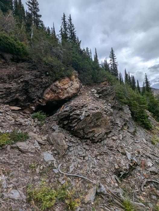
The White Eagle Showing is covered by active crown grants. The workings (developed between 1928-1930) include 7 surface trenches and an upper and lower adit that exposed 2 mineralized quartz veins, targeting sulphide ore shoots with estimated dimensions of 0.6x5.0m. Historical sampling reported up to 74.8 g/t (2.2 oz/ton) Au, 1141.7 g/t (33.3 oz/ton) Ag and 33.80 % Pb.
Lakeview Trenches
Discovered in 1988 the Lakeview showing includes 2 small hand dug trenches exposing two veins (128°/90° & 281°/81°) up to 0.2m wide hosting massive galena-sphalerite-pyrite mineralization. Reports indicate that mineralization is hosted within the veins and as disseminations and cleavage infill within the wall rock. Crews noted that mineralization is comparable to observations made at the White Eagle, approximately 500m to the North. Historical assays indicate that the disseminated wallrock samples returned low grade but samples of vein material returned 144.69 g/t (4.22 oz/ton) Au, 158.06 g/t (4.61 oz/ton) Ag, 6.04% Pb and 3.47% Zn. 2024 confirmation rock sample MMSWR003 (float) collected downslope of the trenches returned 3.40 g/t Au, 17.20 g/t Ag, 0.57% Pb and 0.18% Zn.
West Ridge
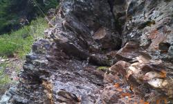
Historic workings developed between 1928-1930 includes 7 trenches and a 15.2m shaft from the ridgetop and a 150m long adit. The mineralized quartz vein (119°/45°) is up to 1.0m wide and hosts pyrite-galena-sphalerite-stibnite-tetrahedrite. Upon re-opening of a historic trench in 1988 field crews exposed a pod of vein hosted massive galena-stibnite mineralization that returned 1539.43 g/t (44.9 oz/ton) Ag, 1.58% Cu, 41.1% Pb and 16.1% Zn. To date this is the only known significant copper mineralization on the property. In 2024 Eagle Plains relocated the historic workings, sample MKSWR001 (float) was collected downslope of a historic trench and returned 47.00 g/t Ag and 1.32% Pb.
Juno
Developed in the 1920’s the lower workings explored a mineralized vein in multiple trenches and an adit. Reported grades include 1.4 g/t Au, 600.0 g/t Ag, 29.0% Pb and 29.8% Zn (Minister of Mines Annual Report 1925). The Juno showing is comprised of the main workings (Lower Juno) and a miner’s cabin marks the “Upper Juno workings” approximately 750m upslope to the SE. The lower workings were located in 1988 by Ambergate Resources but significant mineralization on surface could not be located. Reconnaissance soil sampling by past operators indicate significant base and precious metal enrichment that warrants future follow-up and assessment.
Eagle Plains Exploration
In 2024 Eagle Plains Resources compiled the available data for the Snowstorm area and found that mineralization on the property occurs as sulphides (pyrite-galena-sphalerite±chalcopyrite±stibnite) and lesser sulfosalts (tetrahedrite) hosted in meters-scale quartz-carbonate veins. A single day of prospecting/mapping was completed in 2024 and successfully located and confirmed the high-grade nature of 5 mineral occurrences. Compilation of historical data (and discovery of Pine Tree and Lakeview in 1988) indicate that there are significant exploration targets that were not identified or followed up on by past operators.
Future Work
- Property scale soil geochemistry to assess historic soil anomalies and generate new exploration targets
- Additional prospecting along strike from known workings to assess strike length continuity of mineralization
- Detailed geological mapping and structural interpretation focussing on distribution of mineralization and structural controls
- Mechanical trenching along strike from historic workings
- Follow-up diamond drilling if previous work programs generate significant targets
Eagle Plains - A Project Generator
Eagle Plains Resources is a project generator with several mineral exploration properties of merit that meet qualifying transaction requirements. We facilitate the listing process for capital pool companies and initial public offerings while providing technical expertise for exploration programs. Companies interested in co-operatively exploring any of our projects please contact: Chuck Downie at ccd@eagleplains.com or Mike Labach at mgl@eagleplains.com or call 1 866 Hunt Ore (486 8673).
The Snowstorm project is currently available for option.
Updated November 27, 2024
